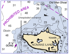
Free Raster Charts from NOAA? Not Yet, Sadly
A lot of extremely useful information for boaters is produced by government agencies. Since those agencies have a mandate to share that information with the public, and since free distribution via the Internet seems like an obvious way to do that, one would think that a lot of government information would be available that way.
Well, some of it is. I previously wrote about the data available from NOAA weather buoys, and I’ll probably be writing in the not-too-distant future about how cool it is that one can download current Coast Pilots and Local Notices to Mariners.
So you’ll understand that I was really excited by this article in the current issue of BoatUS by Elaine Dickinson: Charts go PC.
As digital technology moves forward at an ever-increasing speed, a bewildering array of chart products are out in the consumer marketplace, with more coming. Now, in a major development, the National Oceanic and Atmospheric Administration (NOAA) will soon, if it hasn’t done so by presstime, make its full suite of 970 raster electronic charts of U.S. waters available free to the public via the Internet.
Up until now, boaters with navigation software had to purchase their charts from a vendor or pay a vendor for a subscription to a chart updating service. Now all of the charts, plus weekly “patches” of chart updates, can be downloaded from NOAA at no cost. The site is www.nauticalcharts.noaa.gov.
The change has come about following the expiration of an exclusive agreement between NOAA and Maptech, a private company that co-developed the electronic chart format with the federal agency. Maptech’s Cooperative Research and Development Agreement ended in June, freeing up NOAA to release electronic raster charts to the public since it co-owns the resulting format and files.
Woohoo! Pretty exciting, eh? (At least for a navigational obsessive like me.) Sadly, it turns out that the new program is not yet up and running. After clicking around for a while on the NOAA web site, and finding only information relating to the old, non-free distribution agreement with Maptech, I used the site’s feedback form to ask what was up. The next day I got the following response:
Mr. Callender,
The Office of Coast Survey (OCS) does intends to distribute Raster Nautical Charts (RNCs) and updates for free over the Internet in the same manner as our distribution of Electronic Navigational Charts (see http://nauticalcharts.noaa.gov/MCD/enc/index.htm).
In addition, OCS also anticipates establishing a program by which commercial, value-added providers will be able to download RNCs for free; reformat, encrypt, and/or packaged them with additional data or services; and eventually sell the resulting product for whatever price the market will bear. By adhering to a simple set of NOAA specified practices, these RNCs will retain their official status.
However, as of today (November 7, 2005) a commencement date for either program has not been established by the Office of Coast Survey.
So, no free raster charts for now. But soon, hopefully.
Update: I also wrote to BoatUS magazine to see if they had any more information, and Assistant Editor Michael Vatalaro responded as follows:
NOAA pushed back the release of the raster charts after we went to press. It was supposed to be Mid-October. Right now, they are saying Mid-November. Please check back with them in a few weeks or watch our web site for an update.
So, again with the ‘woohoo!’
Later update: The charts are now available. Yay! See Downloadable Raster Charts Available Free from NOAA.

November 24th, 2005 at 3:52 pm
woohoo is not in order! As taxpayers we should have free access to what the GOV produces with our $s. I have a couple thousand into charts that I paid the GOV to produce, kinda like I have to pay twice. WE Americans should start to demand we receive what we pay for. I figure it’s about time!
November 24th, 2005 at 8:29 pm
Well, the charts are now available for free download. See my more-recent post: Downloadable Raster Charts Available Free from NOAA.
May 8th, 2009 at 5:02 am
so then why have there been raster nautical charts listed at nauticalcharts.noaa.gov in the past but no longer available – like chart #25609 (Anegada)